Topographical Survey
- masum
- April 21, 2026
- Uncategorized
Introduction
Have you ever looked at a piece of land and thought, “What is really under this surface?” Is the land flat, or does it go up and down? Are there hidden slopes, low areas where water can collect, or high areas that are safe for building? These are very important questions, especially if you are planning to build something or invest in land.
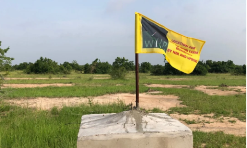
This is where Topographical Survey becomes very useful and important. A Topographical Survey is a method used to study land in detail. It shows the shape, height, and features of the land. It includes both natural features like trees, rivers, and hills, and man-made features like roads and buildings. In simple words, it gives you a full picture of the land before any work begins.
If you start construction without knowing the land properly, you may face serious problems later. Your building may not be strong, water may not drain properly, or the cost may increase. That is why a land survey is always the first and most important step in any project. In this blog, we will explain everything about Topographical Survey in simple English, so anyone can understand and use this knowledge in real life.
What is Topographical Survey?
A Topographical Survey is a type of land survey that measures and maps the physical features of land. It collects data about the land’s height, shape, and surface details. This includes elevation survey, contour mapping, and identifying all visible features on the land.
The main goal of a Topographical Survey is to create a detailed and accurate topographic map. This map helps engineers, architects, and planners understand the land clearly before they start designing or building anything. It reduces risk and improves planning.
Think about it in a simple way. Imagine you are drawing a map of your area. But instead of just showing roads and houses, you also show which areas are higher, which are lower, where water flows, and where trees or open land exist. That detailed map is what a Topographical Survey creates.
Why is Topographical Survey Important?
Many people think surveys are not necessary and try to skip them. But this can lead to big mistakes. Let’s understand why a Topographical Survey is very important.
1. Helps in Safe Construction
Before building anything, you must understand the land condition properly. A site survey helps you know if the land is flat or uneven, strong or weak. It also shows if there are flood-prone areas or slopes that can cause problems.
With proper site analysis, engineers can design safe buildings. They can choose the right place and avoid risky areas. This makes construction more reliable and long-lasting.
2. Saves Time and Money
Skipping a Topographical Survey may seem like saving money at first, but it often leads to higher costs later. If you build without knowing the land, you may face problems like waterlogging, uneven foundation, or structural issues.
Fixing these problems can be very expensive and time-consuming. But with a proper land survey, you can plan everything in advance. This reduces mistakes and helps you complete your project on time and within budget.
3. Better Planning and Design
A Topographical Survey gives clear and detailed information about the land. This helps engineers and designers make better decisions. They can plan where to build, how to design roads, and where to place drainage systems.
For example, with contour mapping, they can understand slopes and design proper water flow systems. This makes the project more efficient and functional. Good planning always leads to better results.
4. Legal and Documentation Support
In many cases, a survey map is required for legal and official purposes. It helps in confirming property boundaries and land ownership. It is also needed for approvals from authorities before starting construction.
A proper topographic map can protect you from legal disputes and confusion. It provides clear and accurate land information that can be used as official proof.
Key Elements of Topographical Survey
To understand this survey better, let’s look at its main elements in simple terms.
1. Elevation (Height)
Elevation means the height of the land from a reference point. A elevation survey shows which parts of the land are high and which are low.
This is very important for planning drainage and avoiding water problems. If water cannot flow properly, it can damage buildings and roads.
2. Contours
Contours are lines drawn on a map to show the shape of the land. These lines connect points of equal height.
If the contour lines are close together, it means the land is steep. If they are far apart, the land is flat. This process is called contour mapping, and it helps in understanding land slope easily.
3. Natural Features
Natural features include things that exist naturally on the land, such as trees, rivers, hills, and soil type. These features affect how land can be used.
For example, a river may require a buffer zone, and trees may need to be preserved. A topographical survey records all these details clearly.
4. Man-made Features
Man-made features are things built by humans, such as roads, buildings, fences, and bridges. These features are important for planning and design.
A topographic map shows both natural and man-made features together, giving a complete view of the land.
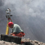
Tools Used in Topographical Survey
You may wonder how surveyors collect such detailed information. They use advanced tools and technology to ensure accuracy.
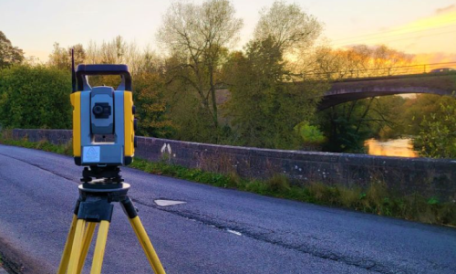
1. Total Station
A Total Station is a modern digital device used in land survey. It measures distance, angle, and height very accurately. It is one of the most important tools in surveying.
2. GPS Survey Equipment
GPS equipment uses satellite signals to find exact locations on Earth. It helps surveyors collect data quickly and accurately over large areas.
3. Drone Survey
Drones are now widely used in topographical survey. They capture aerial images and videos of the land. This method is fast and very useful for large or hard-to-reach areas.
4. Leveling Instrument
This tool is used to measure height differences between points. It is essential for elevation survey and helps in creating accurate maps.
How Topographical Survey is Done
Let’s understand the process in a simple way so anyone can follow it.
1: Site Visit
First, surveyors visit the land. They observe the area and plan how to collect data. This step is important for understanding the site condition.
2: Data Collection
Next, they use tools like Total Station and GPS to collect data. They measure height, distance, and record all features. This is called field survey.
3: Data Processing
After collecting data, it is transferred to a computer. Special software is used to process the data and prepare it for mapping.
4: Map Creation
Finally, a detailed topographic map is created. This map shows all features of the land and is used for planning and design.
Where Topographical Survey is Used
A Topographical Survey is used in many real-life fields. It is not limited to construction only.
1. Construction Projects
Before building houses, roads, or bridges, a site survey is required. It ensures safe and proper construction.
2. Land Development
Developers use land survey data to plan residential and commercial projects. It helps in better land use.
3. Agriculture
Farmers can use topographic map to understand land shape and plan irrigation systems. It improves farming efficiency.
4. Environmental Studies
Experts use surveys to study land and protect nature. It helps in water management and environmental planning.
Types of Topographical Survey
Not all Topographical Survey work is the same. There are different types based on the size of land, purpose, and tools used. Understanding these types will help you choose the right method for your project.
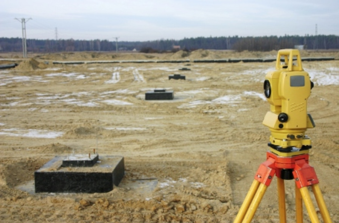
1. Ground Survey (Traditional Survey)
This is the most common type of land survey. Surveyors visit the site physically and use tools like Total Station and leveling instruments to collect data. It is very accurate and useful for small to medium projects.
However, it takes more time and effort because everything is measured manually on the ground. Still, for detailed work, this method is very reliable.
2. GPS Survey
A GPS survey uses satellite signals to collect location data. It is faster than traditional methods and works well for large areas. Surveyors can quickly get accurate coordinates without measuring everything manually.
This method is very useful for road projects, large land development, and mapping big areas. It also reduces human error and saves time.
3. Drone Survey (Aerial Survey)
Drone survey is a modern and popular method of topographical survey. Drones fly over the land and capture high-quality images and videos. These images are then used to create detailed maps.
This method is very fast and cost-effective for large or difficult areas. It also provides a clear visual view of the land, which helps in better planning.
4. LiDAR Survey
LiDAR stands for Light Detection and Ranging. It is an advanced technology used in elevation survey. It uses laser beams to measure distance and create 3D maps of the land.
LiDAR is very accurate and can even capture details under trees or vegetation. It is often used in large infrastructure and environmental projects.
Benefits of Topographical Survey
Now let’s talk about the real benefits. Why should you invest in a Topographical Survey?
1. Accurate Land Information
A topographic map gives exact and clear information about land. This reduces guesswork and helps in making correct decisions.
Accurate data means fewer mistakes and better results.
2. Better Project Design
With proper site analysis, engineers can design projects that fit the land perfectly. They can adjust building plans based on slope and elevation.
This improves safety and performance of the structure.
3. Risk Reduction
A Topographical Survey helps identify risks like flood zones, weak soil, or steep slopes. Knowing these risks early helps you avoid problems.
It protects your investment and ensures long-term success.
4. Improved Communication
A survey map is easy to understand. It helps all team members, including engineers, architects, and clients, stay on the same page.
Clear communication leads to smooth project execution.
Common Mistakes to Avoid
Many people make simple mistakes when dealing with land survey. These mistakes can cause big problems later. Let’s learn how to avoid them.
1. Skipping the Survey
Some people skip the Topographical Survey to save money. This is a big mistake.
Without proper data, your project may fail or cost more in the long run.
2. Choosing Unskilled Surveyors
Not all surveyors have the same skill level. Choosing an inexperienced person can lead to wrong data.
Always hire a professional and experienced survey team.
3. Ignoring Small Details
Small features like minor slopes or drainage paths are often ignored. But these details are very important.
A good site survey includes every detail, big or small.
4. Not Updating Survey Data
Land conditions can change over time. Old survey data may not be accurate.
Always use updated topographic map for your project.
Tips for a Successful Topographical Survey
Here are some simple and effective tips you can use directly.
1. Plan Before Survey
Before starting, define your goal clearly. Know what information you need from the Topographical Survey.
This helps surveyors focus on the right data.
2. Use Modern Technology
Using tools like drones and GPS can improve accuracy and speed. Modern methods provide better results compared to old techniques.
Investing in good technology is always worth it.
3. Work with Professionals
Always hire trained and experienced surveyors. They understand how to collect and process data correctly.
A professional team ensures high-quality results.
4. Review the Survey Map Carefully
After getting the survey map, review it in detail. Make sure all features are included and accurate.
Ask questions if anything is unclear.
5. Keep Records for Future Use
Survey data is valuable. Keep it safe for future reference.
It can help in maintenance, expansion, or legal matters.
Topographical Survey vs Other Surveys

Many people get confused between different types of surveys. Let’s compare Topographical Survey with others in a simple way.
Topographical Survey vs Boundary Survey
A boundary survey focuses on property lines and ownership. It shows where your land starts and ends.
A Topographical Survey focuses on land features, shape, and elevation. It is more detailed and useful for design.
Topographical Survey vs Geological Survey
A geological survey studies soil and underground conditions. It looks at rocks, minerals, and soil strength.
A Topographical Survey studies surface features. Both are important but used for different purposes.
Related Posts