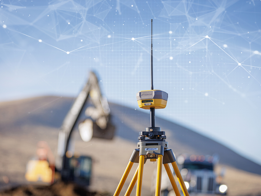
Power Plant Survey (GPS/GNSS)
- masum
- May 10, 2026
- Uncategorized
Introduction
Have you ever wondered how engineers choose the exact place to build a power plant?
A power plant is a very big project. It needs a large area of land, strong soil, good road access, and a safe location. If the location is wrong, the whole project can face serious problems later.
Before construction starts, survey engineers visit the site. They use modern tools like GPS and GNSS to measure land, check height levels, and find exact positions. This helps engineers make smart and safe decisions.
But what is GPS/GNSS survey? And why does it matter so much in power plant construction?
What is Power Plant Survey (GPS/GNSS)?
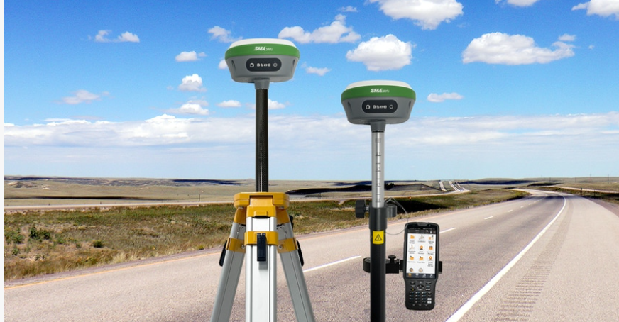
Power Plant Survey (GPS/GNSS) is the process of measuring land and collecting . location data for power plant construction using satellite technology.
In simple words, engineers use satellites in the sky to know the exact point on land.
This method gives very accurate results.
With GPS land survey, engineers can quickly measure . a large area without wasting much time. This saves money and reduces mistakes.
Modern GNSS surveying technology is also very helpful because . it works with many satellites, not just one system. That means better signal and better accuracy.
Why is Survey Important for a Power Plant?
A power plant is not a small building.
It needs a strong foundation, large open land, water connection. roads, and safe distance from homes or danger zones.
Without a proper power plant site survey, problems can happen.
For example:
- Wrong land height measurement can cause waterlogging.
- Weak soil can damage the foundation.
- Bad location planning can create transport problems.
- Wrong boundary marking can cause land disputes.
A survey helps avoid these issues early.
How GPS/GNSS Technology Works
GPS means Global Positioning System.
GNSS means Global Navigation Satellite System.
Both systems use satellites that send signals to survey devices on the ground.
The survey machine receives the signal and finds the exact position.
This position can be accurate within centimeters.
That is amazing, right?
Main Goals of Power Plant Survey
Survey work has many goals.
Each goal is important.
1) Finding the Exact Location
First, engineers must know the exact site location.
Latitude, longitude, and elevation are measured.
This gives a clear land position.
It helps designers prepare maps and plans.
2) Measuring Land Size
A power plant needs enough land.
Surveyors measure total land area carefully.
This is called construction land measurement.
They check length, width, and shape of the land.
3) Checking Height Level
Land is not always flat.
Some parts are high.
Some parts are low. Power Plant Survey (GPS/GNSS).
Surveyors measure elevation to understand land level differences.
4) Marking Boundaries
Every land has limits.
Survey engineers mark exact boundaries.
This prevents future legal problems.
It also helps construction teams know where to work.
Types of Data Collected During Survey
Survey teams collect many kinds of information.
Some important data include:
- Exact coordinates
- Ground elevation
- Slope direction
- Boundary points
- Existing roads
- Water source location
- Nearby buildings
- Utility line positions
Benefits of GPS/GNSS Survey
Modern survey methods are very useful.
Here are some big benefits Power Plant Survey (GPS/GNSS)
High Accuracy
Satellite survey gives exact measurements.
Mistakes become very low. Power Plant Survey (GPS/GNSS)
Fast Work
Large areas can be surveyed quickly.
Lower Cost
Less manpower is needed.
This reduces cost.
Better Planning
Good data creates better design plans.
Construction becomes smoother.
Survey Process
Now you understand why Power Plant Survey (GPS/GNSS) is important.
But how do survey engineers actually do this work?
What happens on the ground?
1) Site Visit and First Inspection
Every survey starts with a site visit.
Engineers go to the land and check the area with their own eyes.
They study the surroundings.
They look for roads, rivers, buildings, trees, hills, and open space.
This first visit gives a basic idea about the land.
It helps engineers make a survey plan.
This step may look simple, Power Plant Survey (GPS/GNSS) but it is very important.
2) Setting Survey Control Points
Next, surveyors set control points.
These are fixed points on the land.
They work like reference marks.
All measurements start from these points.
With GNSS surveying technology, control points can be marked very accurately.
These points help keep every measurement correct.
If control points are wrong, the whole survey can be wrong.
3) Land Mapping
Now the team starts mapping the land.
This is where GPS land survey becomes very useful.
Surveyors walk through the site with survey equipment.
They record exact positions.
Every corner is measured.
Roads are marked.
Nearby structures are recorded.
Natural features like canals or trees are noted.
Then software turns this data into maps. Power Plant Survey (GPS/GNSS).
4) Measuring Ground Height
Height measurement is called elevation survey.
This is a major part of power plant site survey.
Why?
Because land height affects construction.
Low land may collect rainwater.
Uneven land may need cutting or filling.
Some areas may be too steep. Power Plant Survey (GPS/GNSS).
Surveyors check:
- High points
- Low points
- Natural slope
- Water flow direction
5) Boundary Survey
Land boundary must be clear.
This is very important for large projects.
Surveyors mark exact land limits.
They place boundary points.
They prepare records.
This avoids land problems later. Power Plant Survey (GPS/GNSS)
No company wants legal trouble after construction starts.
6) Utility Survey
Surveyors also check nearby utility lines.
For example:
- Electric lines
- Gas lines
- Water pipes
- Drain lines
- Communication cables
This information is important.
Construction should not damage existing systems.
Also, power plants may need utility connections. Power Plant Survey (GPS/GNSS).
Important Equipment Used in Survey
Modern survey work uses smart tools.
Here are common tools:
GNSS Receiver
This receives satellite signals.
It finds exact ground position.
This is the heart of modern survey work.
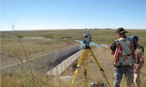
Total Station
This tool measures angle and distance.
It gives detailed site measurement.
Drone Survey
Many companies now use drones.
Drones take pictures from above.
They create fast land maps.
Large areas can be checked easily.
Survey Software
Collected data goes into software.
Software creates:
- maps
- 3D models
- contour plans
- boundary drawings
Common Problems During Survey
Survey work is not always easy.
Engineers face many problems.
Bad Weather
Heavy rain slows work.
Storms can stop survey activity.
Cloud cover may affect signals.
Trees and Buildings
Tall trees can block satellite signals.
Big buildings can also create signal problems.
This reduces accuracy.
Rough Ground
Some land is hard to walk on.
Mud, rocks, and water areas create difficulty.
Survey becomes slower.
Signal Interference
Nearby towers or machines may disturb signals.
Surveyors must be careful.
Tips for Better Survey Results
Here are practical tips:
Use Good Equipment
Modern tools give better accuracy.
Cheap tools may cause mistakes.
Double Check Data
Always verify measurements.
Checking twice is smart work.
Survey in Good Weather
Clear sky gives better satellite signals.
Work becomes easier.
Train the Survey Team
Skilled workers make fewer mistakes.
Knowledge matters a lot.
Survey Data Helps in Design Planning
After survey work is complete, engineers use the data for design.
This is where planning becomes real.
They decide:
- Where the main plant building will stand
- Where roads will be built
- Where drainage lines will go
- Where storage space will be kept
- Where staff buildings will be placed
- Where safety zones will remain open
Without good survey data, design becomes weak.
Role of Survey in Safety
Safety is a big issue in power plant construction.
A survey helps improve safety in many ways.
Flood Risk Check
Low land may collect water.
This can damage buildings.
Survey height data helps engineers solve this early.
Soil Stability Check
Survey teams help identify weak ground areas.
This helps soil testing teams focus on risky spots.
A strong foundation starts with good land study.
Safe Distance Planning
Power plants need safe distance from homes, schools, and busy public areas.
Survey maps help choose the right distance.
Emergency Route Planning
Power plants need emergency roads.
Survey data helps engineers design safe access roads.
How GPS/GNSS is Better Than Old Survey Methods
Old survey methods were slow.
They needed more workers.
They also had more chance of human error.
Modern GNSS surveying technology changed everything.
Faster Work
Large areas can be surveyed quickly.
This saves many working days.
Better Accuracy
Modern satellite systems give highly correct points.
Small mistakes become rare.
Easy Data Sharing
Digital survey data can be shared fast.
Design teams can start work quickly.
Cost Saving
Faster work means lower project cost.
This is good for companies.
Real Tips for Survey Teams
If you work in surveying, these tips can help.
Plan Before Going to Site
Know the area first.
Study maps.
Check weather.
Prepare equipment.
Keep Backup Power
Survey machines need power.
Always carry extra batteries.
Never depend on one battery.
Protect Equipment
Dust, rain, and heat can damage machines.
Use covers and proper storage.
Equipment care improves long-term results.
Record Everything
Write notes.
Save photos.
Store digital files carefully.
Small records become useful later.
Check Coordinates Again
One wrong point can create a big problem.
Always verify key points.
Accuracy is everything.
Future of Power Plant Survey
Survey technology is becoming smarter.
The future looks exciting.
New tools include:
- Smart drones
- AI mapping software
- Live cloud data sharing
- 3D site scanning
- Automatic land modeling
These tools will make power plant site survey faster and more powerful.
Engineers will plan better.
Construction will become safer.
Mistakes will become lower.
Bottom Line / Review
Power Plant Survey (GPS/GNSS) is one of the most important steps before building a power plant.
It helps engineers understand land clearly.
It improves design.
It increases safety.
It reduces mistakes.
Related Posts