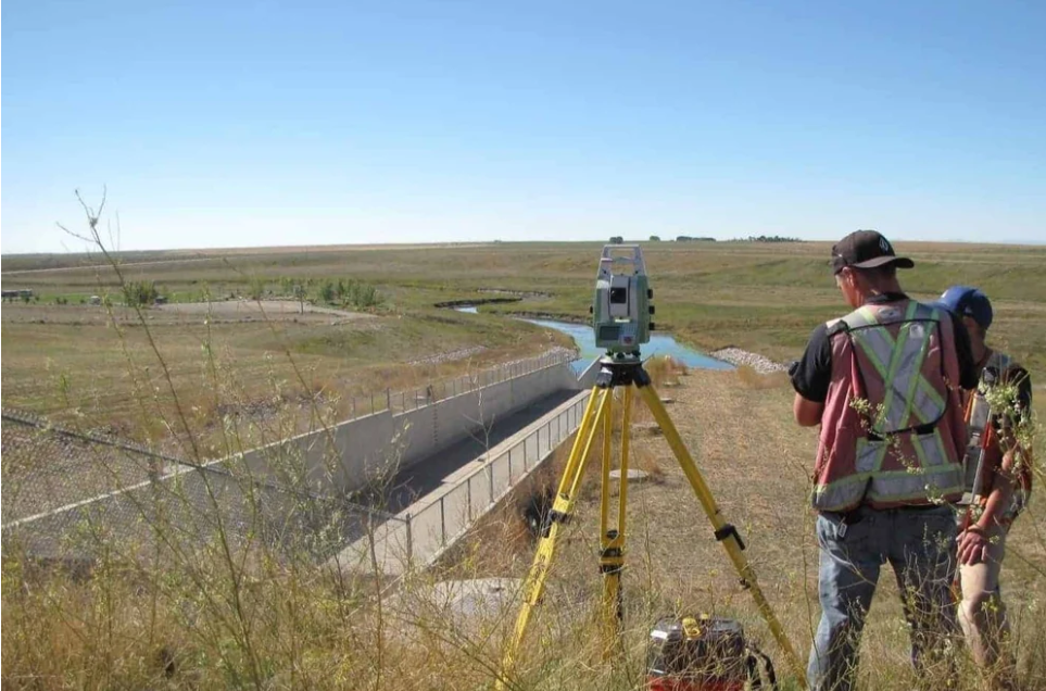
Dam Survey
- masum
- May 13, 2026
- Uncategorized
Introduction
Have you ever wondered how engineers choose the perfect place to build a dam? Why do some dams stay strong for many years while others face problems like cracks. leakage, or flood damage?
The answer is simple. A good Dam Survey is the first and most important step before dam construction starts.
A Dam Survey helps engineers understand the land. water flow, soil condition, and surrounding environment. Without proper surveying, a dam project can become unsafe and costly.
Today, dams are very important for water storage, irrigation systems. hydroelectric power, and flood control. That is why modern survey methods like GPS Survey, GNSS Survey. Total Station Survey, and Drone Mapping are widely used.
In this article, you will learn everything about Dam Survey in very simple English. You will understand survey methods, equipment, process, benefits, challenges, and expert tips.
What is Dam Survey?
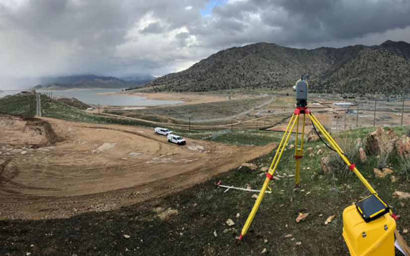
A Dam Survey is the process of measuring and studying land before building a dam.
Survey engineers collect important information such as:
- Land height
- River direction
- Water level
- Soil condition
- Rock structure
- Drainage system
- Environmental impact
This survey helps engineers design a safe and strong dam.
Without a proper survey, the dam may face problems in the future.
Why Dam Survey is Important
A dam is a very large structure. Even a small mistake can create huge danger.
That is why surveying is necessary before construction begins.
1. Helps Select the Best Location
Not every river area is suitable for a dam.
Survey engineers check:
- River width
- Ground stability
- Water flow speed
- Soil strength
2. Reduces Construction Risk
A survey identifies dangerous areas before work starts.
For example:
- Weak soil
- Flood-prone land
- Earthquake risk zones
- Soft ground areas
3. Saves Time and Money
A proper survey helps avoid construction mistakes.
When engineers get correct measurements early. they can work faster and reduce project cost.
4. Improves Water Management
Dams are used for:
- Farming
- Drinking water
- Electricity generation
- Flood control
Main Objectives of Dam Survey
The main goal of a dam survey is to collect accurate field data.
Important Objectives
Site Investigation
Engineers study the full project area carefully.
Topographic Mapping
Surveyors create maps showing:
- Hills
- Rivers
- Roads
- Villages
- Elevation
Soil Testing
The strength of soil is checked.
Water Flow Analysis
Surveyors measure river flow and water level.
Environmental Study
The survey team studies environmental effects on nearby areas.
Types of Dam Survey
Different survey methods are used in dam projects.
1. Topographic Survey
This survey measures ground height and land shape.
It helps engineers understand the natural condition of the area.
Important Data Collected
- Elevation
- Slope
- Contour lines
- Riverbank position
2. Hydrographic Survey
This survey studies underwater areas.
Surveyors measure:
- Water depth
- Riverbed condition
- Flow direction
3. Geological Survey
This survey checks rocks and soil below the surface.
Engineers study:
- Rock strength
- Soil stability
- Earthquake risk
A strong foundation is necessary for dam safety.
4. Environmental Survey
Dam projects can affect nature and local people.
Environmental surveys study:
- Forest impact
- Wildlife impact
- Water pollution
- Human settlement
5. Construction Survey
This survey is done during construction work.
Surveyors guide engineers using exact measurements.
Equipment Used in Dam Survey
Modern technology has made surveying faster and more accurate.
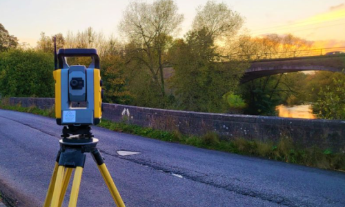
1. Total Station
A Total Station measures:
- Distance
- Angle
- Elevation
2. GPS/GNSS Equipment
GPS Survey and GNSS Survey help surveyors find accurate coordinates.
These systems work using satellites.
Benefits include:
- Fast measurement
- High accuracy
- Easy data collection
3. Drone Survey
Drones are now very popular in dam projects.
They capture aerial images and maps quickly.
Benefits of Drone Mapping
- Saves time
- Covers large areas
- Improves safety
- Creates 3D maps
4. Level Machine
This equipment measures height differences.
It helps maintain proper elevation during construction.
5. Echo Sounder
This tool is used in underwater surveys.
It measures river or reservoir depth.
Dam Survey
1: Preliminary Study
Surveyors first collect basic information about the project area.
They study:
- Old maps
- Satellite images
- River information
2: Field Reconnaissance
The survey team visits the site physically.
They inspect:
- Land condition
- Access roads
- River flow
- Nearby villages
3: Control Point Establishment
Surveyors establish fixed reference points.
These points help maintain accurate measurements throughout the project.
4: Data Collection
This is the main survey stage.
Surveyors collect:
- Coordinates
- Elevation
- Water depth
- Soil information
Modern equipment improves data quality.
5: Mapping and Drafting
Collected data is processed into maps and drawings.
Engineers use software to prepare:
- Contour maps
- Site plans
- 3D models
6: Final Report Preparation
The survey team prepares a detailed report.
This report contains:
- Maps
- Survey findings
- Recommendations
- Safety analysis
Challenges Faced During Dam Survey
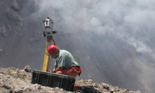
Dam surveying is not always easy. Survey teams often work in difficult places like mountains. forests, rivers, and remote areas.
Bad weather, strong water flow, and rough land can make the work harder. That is why experienced surveyors and modern equipment are very important.
Difficult Terrain Problems
Many dam sites are located in hilly or rocky areas.
Surveyors may need to climb steep land and carry heavy equipment. Sometimes vehicles cannot enter the area easily.
In these situations, Drone Survey becomes very useful. Drones can capture aerial images without putting workers in danger.
Weather Challenges
Rain, storms, and floods can stop survey work.
Heavy rain may increase river water levels suddenly. Strong wind can also affect drone operations and GPS accuracy.
Survey teams must check weather conditions before starting work. Safety should always come first.
Water Flow Measurement Difficulty
Measuring river flow is a very sensitive task.
Water speed changes during different seasons. During monsoon, rivers may become dangerous.
Surveyors use special instruments to measure:
- Water depth
- Current speed
- River discharge
Soil and Rock Investigation Problems
Some areas contain weak soil or cracked rock layers.
These conditions can create serious construction risks later. That is why deep soil testing is necessary.
Engineers often perform:
- Borehole drilling
- Rock testing
- Soil sampling
Environmental and Social Issues
Dam construction can affect local people and nature.
Sometimes villages may need relocation. Forests and wildlife areas can also be affected.
Environmental surveys help reduce these problems. Proper planning protects both people and the environment.
Importance of GPS and GNSS in Dam Survey
Modern dam projects depend heavily on GPS Survey and GNSS Survey technology.
These systems use satellites to provide highly accurate positions.
Benefits of GPS Survey
Fast Data Collection
Surveyors can measure large areas quickly.
This saves project time and labor cost.
High Accuracy
Modern GPS equipment provides very accurate coordinates.
This improves construction quality.
Easy Mapping
Survey data can directly connect with mapping software.
Engineers can create digital maps easily.
Better Project Management
GPS systems help monitor construction progress in real time.
This improves decision-making.
Role of Drone Technology in Dam Survey
Drone technology has changed the surveying industry.
Today, drones are widely used in large infrastructure projects.
They help collect detailed aerial information safely and quickly.
How Drones Help Surveyors
Drones capture high-quality images from the sky.
These images are processed into:
- Orthophotos
- 3D models
- Digital elevation maps
- Terrain models
Advantages of Drone Survey
Saves Time
Large areas can be surveyed within a short time.
Improves Safety
Surveyors do not need to enter risky locations.
Reduces Cost
Drone surveys require fewer workers and less field time.
Better Accuracy
Modern drones provide highly detailed mapping results.
Safety Measures During Dam Survey
Safety is extremely important in dam survey projects.
Survey teams often work near deep water, cliffs, forests, and heavy machinery.
Without proper safety rules, accidents can happen.
Important Safety Rules
Wear Safety Equipment
Surveyors should wear:
- Safety helmet
- Reflective jacket
- Safety boots
- Gloves
Check Weather Forecast
Bad weather can become dangerous during fieldwork.
Always monitor weather updates before starting work.
Maintain Communication
Survey teams should always stay connected using radios or mobile devices.
This helps during emergencies.
Avoid Unsafe Water Areas
Fast-moving rivers can be dangerous.
Surveyors should use life jackets near deep water.
Dam Survey Process Using Modern Technology
Modern surveying combines field equipment with computer software.
This improves both speed and accuracy.
Data Collection Stage
Surveyors first collect raw field data using:
- GPS
- Total Station
- Drones
- Echo Sounders
Data Processing Stage
The collected data is processed using survey software.
Engineers prepare:
- Contour maps
- Cross-sections
- 3D terrain models
Final Design Support
Survey information helps engineers decide:
- Dam height
- Water storage capacity
- Spillway design
- Drainage system
Accurate survey data improves the full project quality.
Common Mistakes in Dam Survey
Some mistakes can create serious problems later.
That is why quality control is very important.
Inaccurate Measurements
Wrong measurements may create design errors.
Even small mistakes can become dangerous in large dam projects.
Surveyors should double-check all measurements carefully.
Poor Control Point Setup
Control points are reference points for the whole project.
If these points are wrong, all survey data may become incorrect.
Ignoring Environmental Impact
Ignoring environmental conditions can create future legal and social problems.
Environmental studies should never be skipped.
Using Old Equipment
Old survey equipment may provide inaccurate results.
Modern technology improves both safety and precision.
Career Opportunities in Dam Survey
Dam survey is an important field in civil engineering and construction.
Many skilled surveyors are needed for infrastructure development.
Popular Job Roles
Land Surveyor
Measures land and prepares maps.
GPS Survey Engineer
Handles satellite-based surveying systems.
Hydrographic Surveyor
Studies underwater conditions and water depth.
GIS Specialist
Processes survey data using mapping software.
Drone Survey Operator
Operates drones for aerial mapping and data collection.
Skills Needed for Dam Survey
A good surveyor should have both technical and practical skills.
Important Skills
- Map reading
- GPS operation
- Drone handling
- Data analysis
- Communication skills
- Problem-solving ability
Future of Dam Survey
Survey technology is improving every year.
Modern projects now use:
- Artificial Intelligence
- LiDAR Mapping
- Satellite Imaging
- Real-time Monitoring Systems
Best Tips for Successful Dam Survey
A successful dam survey needs proper planning, skilled workers, and accurate equipment.
Even small mistakes can create major problems later during construction. That is why survey teams must follow smart working methods.
Plan the Survey Properly
Before starting fieldwork, surveyors should create a complete survey plan.
The plan should include:
- Project area details
- Equipment list
- Safety rules
- Survey schedule
- Team responsibilities
Use Modern Equipment
Modern technology improves survey accuracy.
Using advanced equipment like:
- GPS/GNSS Survey
- Total Station
- Drone Mapping
- Digital Level
- GIS Software
helps collect better data faster.
Old equipment may create measurement errors.
Double Check Field Data
Survey data should always be verified.
Sometimes mistakes happen because of:
- Wrong coordinates
- Instrument setup errors
- Human mistakes
- Weather problems
Maintain Strong Communication
Dam survey projects usually involve many teams.
For example:
- Survey engineers
- Civil engineers
- Environmental experts
- Construction workers
Focus on Safety First
Field safety should never be ignored.
Surveyors often work near:
- Deep water
- Rocky hills
- Heavy machinery
- Remote locations
Environmental Importance of Dam Survey
Dam projects can affect both nature and people.
A proper survey helps reduce environmental damage.
Protecting Rivers and Water Sources
Surveyors study river systems carefully.
This helps engineers design dams that maintain healthy water flow.
Good planning protects:
- Fish habitats
- Water quality
- Natural ecosystems
Reducing Flood Risk
A dam can help control floods if designed properly.
Survey data helps engineers understand:
- Rainfall patterns
- River discharge
- Flood zones
Supporting Agriculture
Many farmers depend on dam water for irrigation.
Proper surveying helps store and distribute water efficiently.
This supports:
- Crop production
- Food security
- Rural development
Role of GIS in Dam Survey
GIS (Geographic Information System) is an important modern survey tool.
It helps engineers manage large amounts of geographic data.
How GIS Helps
GIS combines:
- Maps
- Coordinates
- Satellite images
- Terrain data
into one digital system.
Engineers can easily analyze the project area using GIS software.
Benefits of GIS in Dam Projects
Better Decision Making
GIS helps engineers understand land conditions clearly.
Easy Data Management
Large survey data can be stored and updated easily.
Improved Visualization
GIS creates digital maps and 3D terrain models.
Difference Between Dam Survey and Regular Land Survey
Many people think all surveys are the same.
But dam surveys are more complex than normal land surveys.
Regular Land Survey
A normal land survey mainly measures:
- Property boundaries
- Land area
- Building positions
It is usually done for small construction projects.
Dam Survey
A dam survey includes:
- River study
- Water flow analysis
- Soil testing
- Environmental study
- Geological investigation
It requires advanced engineering knowledge.
Real-Life Applications of Dam Survey
Dam surveys are used in many important projects around the world.
Hydroelectric Power Projects
Many dams generate electricity using water power.
Survey data helps design safe power generation systems.
Irrigation Projects
Large farming areas need water supply systems.
Dam surveys help manage agricultural water distribution.
Flood Protection Systems
Dams help reduce flood damage in vulnerable areas.
Surveying improves flood control planning.
Drinking Water Supply
Many cities depend on dam reservoirs for clean water.
Proper surveys help maintain safe water storage systems.
Need for Skilled Experts
Complex survey projects require experienced professionals.
Training is very important in this field.
Future Technology in Dam Survey
Technology is changing very fast.
Future dam surveys will become even smarter.
LiDAR Technology
LiDAR Survey uses laser scanning to create highly accurate terrain maps.
It works very well in forests and rough land.
Artificial Intelligence (AI)
AI systems can analyze survey data faster.
Real-Time Monitoring Systems
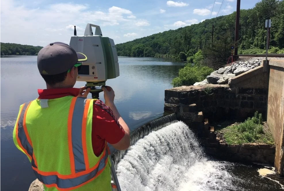
Modern dams now use sensors to monitor:
- Water pressure
- Structural movement
- Water level
Satellite Remote Sensing
Satellites help monitor large areas from space.
This technology improves environmental and water management studies.
Bottom Line
A Dam Survey is one of the most important parts of dam construction and water management.
It helps engineers understand land, water, soil, and environmental conditions before construction starts.
Modern technologies like GPS Survey, GNSS Survey, Drone Mapping, GIS. Total Station Survey have made dam surveying faster, safer, and more accurate.
Related Posts