Geographical Survey
- masum
- April 21, 2026
- Uncategorized
Introduction
Every road you travel, every building you see, and every land boundary you notice is not random. Everything is carefully measured and planned using a process called Geographical Survey. This is the hidden science behind the world we live in. It is the base of construction, mapping, farming, and city planning. Without it, modern life would not be organized or safe.
A Geographical Survey is the process of measuring land, earth surface, and natural features like rivers, hills, and forests. It helps us understand the real shape, size, height, and position of land. In very simple words, it is like taking the earth’s “exact measurement” so that humans can use land in a smart and safe way. This process turns raw land into useful information.
Do you think only engineers use it? No. It is used in daily life more than we realize. When a house is built, when a road is designed, or when a city map is made, survey data is always used. Even farmers and government planners depend on it. It silently supports almost every development work around us.
What is Geographical Survey?

A Geographical Survey is a scientific method of collecting information about land and physical features. It measures distance, direction, height, and position of different objects on the earth. This data is then used to create maps, plans, and models that help in decision making. It is also known as land surveying or earth measurement study.
The main purpose of this process is to provide correct and accurate land data. This data is used for planning roads, buildings, bridges, farms, and even disaster management systems. Without correct survey data, construction projects can become unsafe or fail completely.
Why Geographical Survey is So Important
Geographical survey plays a very important role in modern development. Without it, no large project can be completed properly. It ensures safety, accuracy, and proper planning in all types of land use activities. It is the first step before starting any construction or development work.
For example, if a road is built without proper survey, it may go through weak soil or flood-prone areas. This can cause accidents and damage. Similarly, if a building is constructed without knowing land strength and size, it can collapse or become unsafe. That is why survey is always done before starting any project.
It is also important for legal reasons. Land ownership disputes are very common, and survey data helps to clearly define property boundaries. This reduces conflict between people and ensures fair land distribution.
Real-Life Use of Geographical Survey
Geographical survey is not just theory; it is used everywhere in real life. When a city is planned, survey data is used to design roads, drainage systems, and residential areas. When a farmer divides land into different parts for crops, survey helps to measure equal portions. When flood control systems are built, land height data from surveys is used.
Even GPS navigation systems in mobile phones are based on survey and mapping data. Every time you use Google Maps, you are indirectly using geographical survey results. This shows how deeply it is connected to modern life.
Types of Geographical Survey
There are several types of geographical survey, and each one has a special purpose.
Topographical Survey is used to study land shape, height, hills, rivers, and natural features. It helps in making detailed maps of an area.
Cadastral Survey is used to measure land boundaries and property ownership. It is very important for legal land records.
Engineering Survey is used for construction projects like roads, bridges, railways, and buildings. It ensures proper design and safety.
Aerial Survey uses drones or aircraft to capture images of large land areas from above. It is fast and very useful for big projects.
Hydrographic Survey is used to study water bodies like rivers, lakes, and seas. It helps in navigation and underwater construction.
Each type of survey plays a different but important role in understanding and using land properly.
Basic Idea of Survey Work
Survey work is basically about measuring land carefully and converting it into useful information. Surveyors collect data about distance, direction, height, and angle between different points on land. This data is then used to draw maps or create digital models.
In simple terms, survey work is like drawing a picture of real land on paper or computer. But this picture must be extremely accurate. Even a small mistake can cause big problems in construction or planning. That is why surveyors work very carefully and follow proper methods.
Tools Used in Geographical Survey
Surveyors use many tools to measure land. Some are simple, and some are very advanced.
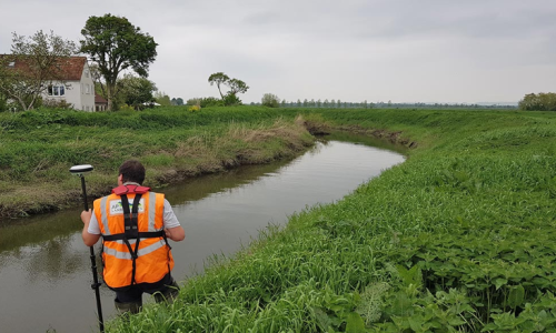
Traditional tools include measuring tape, compass, and leveling instruments. These are used for basic field work. Modern tools include GPS devices, drones, and digital theodolites. These tools provide high accuracy and fast results.
Today, most surveys are done using digital technology. Satellite-based systems help to find exact locations within seconds. This makes survey work faster and more reliable than ever before.
Conclusion
Geographical survey is the foundation of all modern development. It helps us understand land in a clear and scientific way. From roads to buildings and farms to cities, everything depends on accurate survey data. Without it, planning would be impossible and unsafe.
Methods and Techniques of Geographical Survey
How do surveyors measure land so accurately in real life?
The answer is simple. They use different methods, tools, and techniques depending on the type of land and purpose of work. Each method has its own advantage and use. Some are simple and old, while others are modern and digital. Let’s understand them in detail.
Chain Survey Method
Chain survey is one of the oldest and simplest methods of land measurement. In this method, surveyors use a chain or measuring tape to measure straight distances on land. They divide the land into triangles and measure each side carefully. This method is mainly used for small and flat areas like fields or open land.
The biggest advantage of chain survey is its simplicity. It does not require advanced tools or technology. However, it is not suitable for large or complex areas because it can become less accurate over long distances.
Compass Survey Method
Compass survey is used to measure direction along with distance. A magnetic compass is used to find directions like north, south, east, and west. Surveyors measure angles between different points to create a rough map of the land.
This method is useful in forest areas or places where straight measurement is difficult. It gives a better understanding of land direction and layout compared to chain survey.
Plane Table Survey Method
Plane table survey is a unique method where drawing and measurement are done at the same time. A drawing board is placed in the field, and surveyors directly draw the map while measuring land. This method saves time and gives immediate results.
It is mainly used for small to medium areas where quick mapping is required. It is simple, but requires skill and experience for accuracy.
Leveling Survey Method
Leveling survey is used to measure the height of land. It helps to identify which areas are high and which are low. This method is very important for road construction, drainage systems, and flood control planning.
Without leveling survey, water flow and building stability cannot be properly planned. It ensures that structures are built on safe and stable ground.
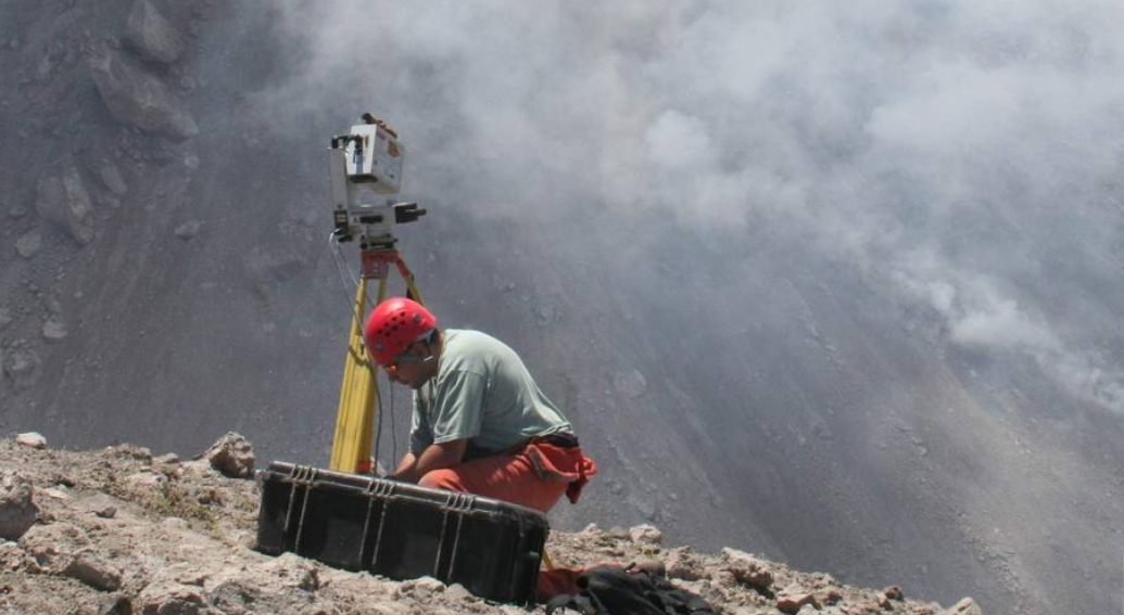
GPS Survey Method
GPS survey is a modern and advanced method that uses satellites to find exact location on earth. It provides very high accuracy and works in real time. Surveyors can collect large amounts of data quickly using GPS devices.
This method is widely used in modern construction, mapping, and navigation systems. It is fast, reliable, and reduces human error.
Drone Survey Method
Drone survey uses flying drones equipped with cameras to capture images of land from above. It is very useful for large areas like cities, forests, and construction sites.
Drones can capture detailed images and create 3D maps. This method saves time and reduces physical effort. It is one of the fastest growing technologies in surveying.
Conclusion
Survey methods have evolved from simple chains to advanced satellites and drones. Each method has its own role depending on the project. Modern technology has made surveying faster, more accurate, and more efficient than ever before.
Applications, Benefits & Final Review
Why is geographical survey so important in real development?
Because every major project in the world starts with it. Without survey data, planning becomes guesswork, and that can lead to serious problems in construction and land use.
Use in Construction Industry
In construction, geographical survey is the first and most important step. It helps engineers understand land conditions before building anything. Roads, bridges, tunnels, and buildings all depend on survey data for safe design.
Without proper survey, structures may become weak or unsafe. That is why no construction project starts without land measurement.
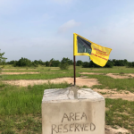
Use in Real Estate and Property
In real estate, survey helps in defining property boundaries clearly. It ensures that land ownership is correct and legal. Buyers and sellers depend on survey reports to avoid disputes.
It also helps in measuring exact land size, which is important for fair pricing and legal documentation.
Use in Agriculture
Farmers use survey techniques to divide land properly and manage irrigation systems. It helps in planning crop areas and water distribution. This improves farming productivity and reduces waste of resources.
Use in City Planning
City planning is not possible without survey data. Roads, housing, drainage systems, and public services are designed based on survey maps. It helps create organized and safe cities.
Environmental Use
Survey is also used in environmental protection. It helps study forests, rivers, and flood areas. It is useful for disaster management and climate planning.
Benefits of Geographical Survey
Geographical survey provides many benefits. It gives accurate land data, supports safe construction, avoids legal disputes, and improves planning efficiency. It also saves time and reduces cost in large projects.
Future of Geographical Survey
The future of surveying is very advanced. Technologies like AI, drones, satellites, and 3D mapping are making the process faster and smarter. In the future, surveys will become fully digital and automated.
Final Bottom Line
Geographical survey is the backbone of modern development. It connects science, technology, and real-life planning. From small fields to large cities, everything depends on it.
Related Posts