Boundary Demarcation
- masum
- April 22, 2026
- Uncategorized
Introduction
This is a very common question for every homeowner. If you do not know your exact property lines, it can lead to big problems and fights in the future.
To protect your investment, you must follow a process called Boundary Demarcation. It is the most important step to make sure no one can illegally take even an inch of your soil. Without a clear and legal boundary, your property is like a house without a lock—anyone can try to enter or claim it.
Do you want to keep your land safe from land disputes? Knowing your geographic boundaries gives you the confidence. to build fences or sell your property without any stress. In this guide, we will explain everything about land measurement in very simple words
Why is it so important to have a professional land survey done for your property right now? In this guide, we will break down everything you need to know about land measurement in very simple words. We will show you how to use modern technology and legal steps to make sure your land stays yours forever.
What is Boundary Demarcation?
Boundary Demarcation means finding and marking the exact limits of a piece of land. Think of it like drawing a line on the ground to say, “This is my space.” It helps people avoid confusion.
When we talk about property lines, we are talking about legal lines. You cannot see these lines with your eyes unless you use a professional land surveyor. These experts use special tools to find the geographic boundaries of your area.
Why is it Important for You?
Why should you care about a simple line? Well, imagine building a beautiful wall, only to find out it is on your neighbor’s land! That would be a waste of money.
Proper land measurement keeps you safe from legal trouble. It also makes your property more valuable. If you want to sell your house, the buyer will ask for a site plan. If your borders are clear, you can sell it faster. Boundary Demarcation
How Does the Process Work?
The process of legal boundary marking is not just about driving a stick into the mud. It involves several steps:
- Checking Old Records: First, experts look at old maps and deed records. These papers tell the history of the land.
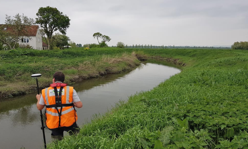
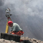
- Field Visit: A surveying professional comes to your land. They use GPS and other high-tech tools.
- Finding Markers: They look for old iron pins or stones hidden under the grass.
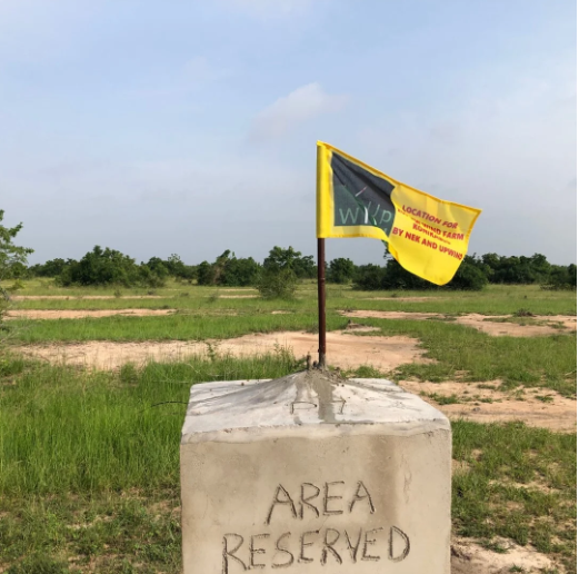
- Setting New Marks: Once they find the spot, they put new boundary markers like pillars or flags.
Common Problems and Solutions
Sometimes, your neighbor might not agree with your boundary identification. This is called a land dispute.
Tip 1: Never argue or shout. It makes things worse. Tip 2: Always look for your property deed. This paper is your best friend in a fight. Tip 3: If the neighbor is still angry, call a mediator. Boundary Demarcation A mediator is a person who helps two people agree without going to court.
Using Technology for Accuracy
In the old days, people used long ropes or chains to measure land. But today, we have digital mapping. Using a total station or a drone makes the work very fast. Boundary Demarcation
GPS surveying is the most accurate way now. It uses satellites from space to find your land coordinates. This means there is almost zero chance of a mistake. Even a few inches can matter when the land is very expensive!
The Role of Local Government
Every area has a local land office. They keep the cadastral maps. These are big maps that show every piece of land in the city or village.
Before you start any construction project, you must visit this office. They will give you the official boundary report. This document is necessary if you want to take a bank loan or get a building permit. Boundary Demarcation
How to Prepare for Land Surveying
Before the land surveyor arrives at your property, you need to do some homework. It is not just about showing them the land; you must have all your property documents ready and organized. Check your land deed or “Dalil” very carefully to see the total area mentioned. If you have old cadastral maps from your local land office, keep them ready. These maps are very important because . they show the historical boundaries of your land. When you show these papers to the land surveyor, they can work much faster.
Having your documents organized also reduces the chance of any measurement errors. It is always better to double-check with old records to make sure your property lines are 100% correct. This simple preparation saves you time and protects your land from future mistakes.
Also, it is a very good idea to talk to your neighbors before the surveying process begins. This simple step can prevent a future land dispute and keep the peace in your neighborhood. Remember, a clear conversation today can save you from a big legal battle tomorrow. Boundary Demarcation
Guide to Placing Markers
Once the professional finds the exact property lines. it is time to put permanent boundary markers. Many people use wooden sticks, but these are not good because they rot in the rain or can be moved by someone easily. It is much better to use concrete pillars or heavy iron pipes that are buried deep into the ground. Boundary Demarcation These permanent markers act as a physical proof of your . land ownership and are very hard to change without someone noticing. Make sure the pillars are tall enough so they are visible even if the grass grows long or if it floods. Boundary Demarcation
After the markers are placed, you should take clear photos of each corner of your land. These photos act as digital evidence of your boundary demarcation. If someone tries to move the pillar later, you can show the photos to the local authorities or the police. You can also write down the GPS coordinates of each marker using a smartphone app. This is a modern way of land tracking that adds an extra layer of security to your valuable property. Always remember, protecting your land starts with a strong and visible border.
Understanding Legal Land Rights
In many places, the law gives you the legal right to mark your land. However, you must follow the local zoning laws. For example, you cannot always build a very high wall exactly on the boundary line. Boundary Demarcation A tall wall might block the public road or stop sunlight from reaching your neighbor’s house.
Before you start any fence installation. it is a very good idea to talk to your local municipality or “Union Parishad.” They will tell you the rules about how much space to leave.
If you see that your neighbor has already built a wall or a shed on your land, this is called encroachment. You should first try a friendly settlement . by showing them your official survey report. Boundary DemarcationIf they refuse to move their structure, you might need to send a legal notice through a lawyer. This document officially informs them that they are violating your land title. Most people get scared and agree to move when they see a formal legal paper, so you might not even need to go to court.
The Cost of Boundary Demarcation
Many people ask, “Is hiring a professional surveyor too expensive?” The truth is, the cost of a land survey is much lower than the cost of losing a piece of your land. The price usually depends on the size of the plot and how difficult the ground is. If the land is full of bushes and trees, the surveying crew will take more time to clear the path. It is always better to get a written estimate before the work starts so there are no hidden charges later.
Think of this cost as an investment in security. A property with a clear legal boundary and a fresh site plan is much easier to sell or use as collateral for a bank loan. Buyers and banks love clear papers because it means there is no risk of a property lawsuit. So, spending a little money now on accurate measurement . Boundary Demarcation will give you a lot of peace of mind and financial safety in the long run.
Modern Technology in Land Surveying
In the past, people used simple chains or ropes to measure land, which often led to mistakes. But today, we use satellite technology . and Laser Distance Meters to get the most accurate results. One of the most popular tools used by professionals is the Total Station. This machine can measure angles and distances at the same time with very high precision. When a qualified surveyor uses this technology, the chance of making an error is almost zero. This ensures that your legal boundary is marked exactly. where it should be according to the government maps.
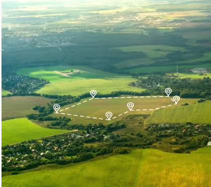
Another amazing technology is the use of Drones for Surveying. Drones fly over your property and take hundreds of high-resolution photos. These photos are then combined using special software to create a 3D Topographic Map. This is very helpful if your land is very large or has difficult areas like ponds or steep hills. By using Aerial Mapping . you can see your entire property from above and identify. any boundary issues very quickly.
Expert Tips for Every Landowner
Protecting your land is a long-term job. Here are some real and effective tips that you can use directly to keep your property safe:
- Tip 1: Create a Living Fence: If you don’t want to . build a brick wall immediately, plant a row of trees or a hedge boundary along the line. This creates a natural and permanent marker that is beautiful and hard to move.
- Tip 2: Regular Inspections: Visit your land at least once a month. Check if your boundary pillars are still in the right place. Sometimes, rain or animals can move markers, or worse, someone might try to push them slowly. Regular monitoring is the key to preventing theft of your land.
- Tip 3: Keep Digital Backups: Scan all your land survey documents and keep them in your email or Google Drive. If the original paper gets lost or damaged by fire. Boundary Demarcation your digital records will save you during a legal dispute.
- Tip 4: Hire Certified Professionals: Never hire an amateur just because they are cheap. Only use a licensed land surveyor who is recognized by the local government. Their signature on a survey report holds weight in court, while an amateur’s paper does not.
How to Handle Neighbors During the Process
It is important to stay calm and follow a professional approach. If they disagree with the marks, show them your certified site map . and explain that the measurements are based on official records. If they still don’t listen, do not start a physical fight. Instead, suggest a joint survey where both of you hire one or two experts to measure the land together.
A joint boundary survey is often the best way to solve . problems because both parties see the results at the same time. This creates mutual trust and prevents long-lasting anger between neighbors. If the neighbor still refuses to accept the truth. you have the right to call the local police or the land sub-registrar to intervene. Always remember, the goal is to have a clear property line. while maintaining a good relationship with the people living next to you.
Bottom Line: The Importance of Clarity
In conclusion, Boundary Demarcation is not just about measuring soil. it is about protecting your hard-earned money and your peace of mind. Without clear property borders, you are always at risk of losing . your land or getting into expensive legal troubles. Whether you are building a home, starting a farm. or just holding the land as an investment, knowing your exact coordinates is a must.
By following the steps in this guide. from checking your deed records to using modern GPS tools. you can ensure that your land remains yours forever. Boundary Demarcation Don’t wait for a fight to happen; be proactive.
Related Posts