Flyover Survey
- masum
- May 2, 2026
- Uncategorized
Introduction
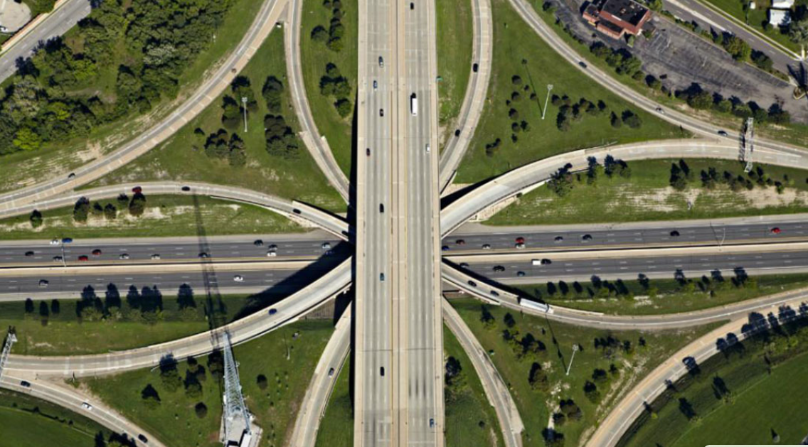
Have you ever crossed a big flyover and wondered—how did engineers make it so strong and straight?
How do they know where to build the pillars exactly?
This is where Flyover Survey comes in.
A flyover survey is a very important process in road and bridge construction. It helps engineers find the right position, height, and direction before building starts. Without this survey, a flyover can become unsafe or wrongly aligned.
In this blog, you will learn everything in very simple words.
What is Flyover Survey?

A flyover survey is a special type of land measurement used before building a flyover or overpass.
It helps engineers understand:
- Where the flyover will start
- Where it will end
- Where pillars will be placed
- How high the structure should be
Why Flyover Survey is Important?
If we do not do proper survey, many problems can happen:
- Wrong alignment of road
- Weak structure design
- Traffic safety issues
- Cost increase in construction
Main Purpose of Flyover Survey
The main goals are:
- Find correct road path (road alignment survey)
- Measure land height and slope
- Identify obstacles like buildings or drains
- Design safe structure points
It ensures the flyover is strong and safe.
Types of Surveys Used in Flyover Construction
1. Topographic Survey
This survey shows land shape, height, and features.
It is called topographic survey.
Engineers use it to understand hills, slopes, and flat areas.
2. Control Survey
This survey creates reference points on land.
These points help in accurate construction.
It is part of engineering control survey.
3. Alignment Survey
This decides the exact path of the flyover.
It is known as road alignment survey.
4. Detail Survey
This gives full details of the land like trees, roads, and buildings.
Tools Used in Flyover Survey
Engineers use modern tools like:
- Total Station
- GPS Survey Equipment
- Theodolite
- Level Machine
These tools help in accurate measurement.
Basic Steps of Flyover Survey
1: Study the area
2: Collect land data
3: Mark reference points
4: Measure height and distance
5: Prepare survey map
This map is called survey layout drawing.
Who Does Flyover Survey?
This work is done by:
- Civil Engineers
- Survey Engineers
- Construction Survey Teams
They are trained professionals.
Simple Example
Imagine a busy road in a city.
Engineers want to build a flyover above it.
First, they study traffic flow.
Then they measure land.
Then they design pillar positions.
This full process is flyover survey
Methods, Process & Field Work
How Flyover Survey
Now we will understand the real field process.
1: Site Inspection
Engineers visit the location first.
They observe:
- Traffic movement
- Land condition
- Nearby buildings
- Road width
This is called site reconnaissance survey.
2: Establish Control Points
Small markers are placed on ground.
These are called survey control points.
They help maintain accuracy.
3: Measurement of Land
Now engineers measure:
- Distance
- Height
- Slope
This is done using Total Station survey method.
4: Alignment Design
Engineers decide where flyover will go.
This is called flyover alignment planning.
They ensure:
- Smooth curve
- Safe turning radius
- Proper elevation
5: Leveling Work
Leveling means checking height difference.
This is part of levelling survey.
It ensures the flyover is not tilted.
6: Mapping and Drawing
All data is converted into maps.
This is called:
- Survey drawing
- Engineering layout map
These maps guide construction workers.
Important Factors in Flyover Survey
1. Traffic Flow
Survey must consider traffic density.
2. Soil Condition
Strong soil is needed for pillars.
3. Drainage System
Water flow must not block construction.
4. Safety Area
Space must be enough for construction work.
Challenges in Flyover Survey
Sometimes engineers face problems like:
- Crowded urban areas
- Underground utilities
- Weather issues
- Limited space
These make survey work difficult.
Modern Technology in Survey
Now advanced tools are used:
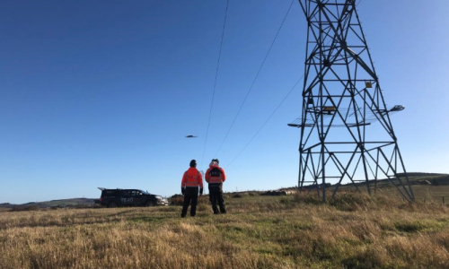
- Drone survey
- 3D mapping
- Laser scanning
These improve accuracy.
This is called modern construction surveying technology.
Why Accuracy is So Important?
Even small mistake can cause:
- Structure failure
- Cost loss
- Delays
So engineers check data many times.
Simple Real-Life Example
Think about a flyover in Dhaka city.
Before building, engineers measure every inch of land.
They check roads, buildings, and traffic.
Then they design safe structure.
That is flyover survey in real life.
Importance, Benefits & Conclusion
Importance of Flyover Survey in Construction
Flyover survey is very important for modern cities.
Without it, no flyover can be built safely.
It supports:
- Urban development
- Traffic management
- Road safety
It is a key part of civil engineering survey work.
Benefits of Flyover Survey
1. Safe Construction
It reduces risk of accident or collapse.
2. Proper Design
Engineers design better structure.
3. Cost Saving
Avoids mistakes and extra cost.
4. Time Saving
Construction becomes faster.
5. Traffic Improvement
Flyovers reduce road congestion.
Real Use in Cities
Flyover survey is used in:
- Highways
- Urban roads
- Industrial zones
- Airport roads
Every big infrastructure needs it.
Future of Flyover Survey
In future, survey will become more advanced.
We will see:
- AI-based mapping
- Smart drones
- Real-time 3D modeling
This will make construction more accurate.
Common Mistakes to Avoid
- Ignoring soil test
- Wrong alignment
- Poor measurement
- Skipping control points
Engineers must avoid these.
Who Benefits from Flyover Survey?
- Government
- Engineers
- Contractors
- Public users
Everyone gets benefit from safe roads.
Bottom Line / Review
Flyover survey is the first and most important step before building a flyover.
It helps engineers design safe, strong, and smart road structures.
Without this survey, modern transport systems cannot exist.
It is the backbone of all bridge and flyover construction.
Related Posts