Irrigation Survey
- masum
- May 9, 2026
- Uncategorized
Introduction
Have you ever thought about how water reaches a farm field at the right time?
Plants need water to grow. But giving water is not only about opening a pump or canal. Water must go to the right place, in the right amount, and at the right time. This is where Irrigation Survey becomes very important.
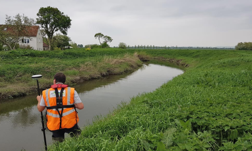
An Irrigation Survey is the process of studying. land before making an irrigation system. Engineers and survey teams check the shape of the land, soil type. water source, slope, and drainage system. This helps them make a smart plan for water supply.
Without proper survey work, irrigation systems may fail. Water may stop in one area. Some places may get too much water, while others stay dry. This can damage crops and waste money.
A good survey saves water, time, and cost. It also helps farmers grow healthy crops.
What is Irrigation Survey?
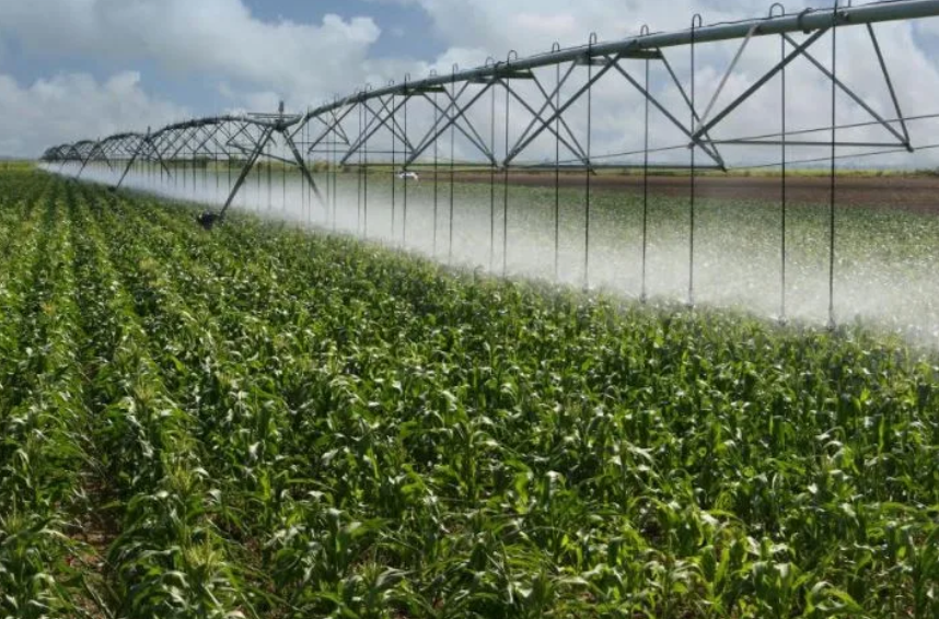
Irrigation Survey means measuring and studying land for water supply planning.
The main goal is simple. It helps experts understand how water can move from the source to the field safely and easily.
Survey teams collect many details. They check land height, field size. soil condition, nearby canals, rivers, ponds, and underground water sources.
They also study how rainwater moves in that area. This is important for better planning.
With this information, engineers design a strong irrigation system.
Why Irrigation Survey is Important
Water is life for crops. But poor water planning creates many problems.
A proper irrigation survey solves these problems early.
1) Better Water Distribution
Not all land is flat. Some land is high, and some land is low.
Survey work helps find the slope of land. Then engineers can plan water flow easily.
This creates better water management.
Every crop gets enough water.
2) Saves Water
Water is becoming limited in many places.
A survey helps avoid water waste.
It supports efficient irrigation planning.
Farmers can use less water and get better crop growth.
3) Low Construction Cost
Wrong planning means future repair costs.
A proper survey reduces mistakes.
This helps in irrigation system design at lower cost.
4) Improves Crop Production
Healthy water supply means healthy crops.
This increases farming success.
It supports agricultural land survey for better farming.
Main Purpose of Irrigation Survey
There are many goals behind survey work.
Find Water Source
First, experts check where water will come from.
It may be from:
- River
- Canal
- Lake
- Pond
- Tube well
- Rainwater storage
Choosing the right source is very important.
This is part of water source assessment.
Measure Land Shape
Every field has a different shape.
Surveyors measure:
- Length
- Width
- Height difference
- Land slope
- Boundary line
This is called land measurement survey.
Check Soil Condition
Soil affects water flow.
Some soil absorbs water fast.
Some soil keeps water longer.
Survey teams test soil carefully.
This helps in soil analysis for irrigation.
Study Drainage System
Extra water must leave the field safely.
If water stays too long, crops may die.
Good drainage planning is important.
This supports farm drainage planning.
Types of Irrigation Survey
Different projects need different surveys.
Reconnaissance Survey
This is the first visit.
Survey teams check the area quickly.
They collect basic information.
It gives an early idea about the project.
Preliminary Survey
This is a detailed study.
Teams collect more measurements.
Maps are prepared.
Costs are estimated.
Detailed Survey
This is the final survey stage.
Everything is measured carefully.
Engineers use this data for final design.
This supports irrigation project planning.
Tools Used in Irrigation Survey
Many tools are used in survey work.
Common tools include:
- Measuring tape
- Level machine
- GPS device
- Drone survey camera
- Total Station machine
- Soil testing tools
- Water flow meter
Steps of Irrigation Survey
An irrigation survey follows a clear process.
Each step is important. Missing one step can create problems later.
1) Site Visit and Inspection
First, survey engineers visit the land.
They look at the whole area carefully. They check roads, nearby water sources, crop fields, and village locations.
They also talk with local farmers. Farmers know the land well.
This helps in field inspection for irrigation.
2) Land Measurement
Next, the land is measured.
Surveyors check length, width, and total area.
They also measure high and low points.
This helps understand where water will move naturally.
This supports topographic survey work.
3) Level Survey
Level survey means checking land height.
Even small height differences matter in irrigation planning.
Water always moves from high land to low land.
Knowing the level helps engineers design canals and water paths.
This improves water flow planning.
4) Soil Testing
Soil is tested carefully.
Some soil absorbs water very fast.
Some soil holds water for a long time.
Clay soil keeps water more. Sandy soil loses water quickly.
This helps in soil moisture management.
5) Water Source Study
Survey teams check the water source deeply.
They measure:
- Water amount
- Water quality
- Seasonal changes
- Distance from field
- Pumping cost
This is part of water resource planning.
6) Drainage Check
Extra water must leave the land safely.
If drainage is poor, roots become weak.
Standing water can also create plant disease.
Good drainage supports crop water management.
Types of Irrigation Systems
Survey work helps choose the best irrigation system.
Different land needs different methods.
Surface Irrigation
This is the oldest method.
Water moves across the land by gravity.
It is simple and low cost.
But it may waste water.
It is common in rice farming.
This is part of surface water irrigation.
Drip Irrigation
Drip irrigation gives water slowly near plant roots.
Very little water is wasted.
Plants get water directly.
This system saves money in the long run.
It supports smart irrigation system planning.
Sprinkler Irrigation
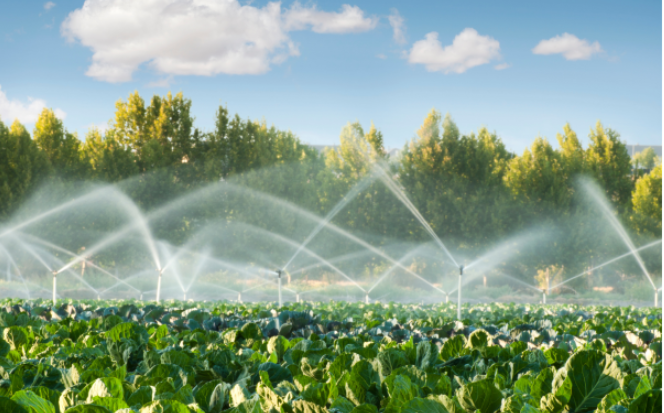
Sprinklers spread water like rain.
This is useful for vegetables, grass, and gardens.
Water spreads evenly.
This method supports modern irrigation methods.
Underground Irrigation
Water moves below the soil surface.
Roots get water directly.
This reduces water loss.
But setup cost is high.
Problems Found During Irrigation Survey
Survey teams often find many issues.
Finding them early is helpful.
Uneven Land
High and low land creates water flow problems.
Some areas stay dry.
Some areas collect too much water.
Land leveling may be needed.
Weak Water Source
Sometimes water supply is not enough.
In dry season, rivers become small.
Tube well water may also go down.
Survey teams check backup options.
Bad Soil
Some land cannot hold water well.
Water quickly disappears underground.
Extra planning becomes necessary.
Drainage Problems
Poor drainage damages crops.
It also weakens soil quality over time.
Drainage channels may need construction.
Real Benefits of Proper Irrigation Survey
A good survey gives long-term value.
Better Crop Yield
Plants receive the right amount of water.
This helps healthy growth.
Farmers can harvest more crops.
Less Water Waste
Water goes only where needed.
This improves water conservation in farming.
Lower Farming Cost
Less water waste means less pump cost.
Repair cost also becomes lower.
This helps farmers save money.
Strong Future Planning
A survey creates useful records.
Future expansion becomes easier.
New canals or pumps can be added later.
This supports sustainable irrigation planning.
Modern Technology in Irrigation Survey
Today, irrigation survey work is faster and smarter.
Modern tools help engineers collect correct data in less time. This reduces mistakes and improves planning.
Technology also saves labor cost.
This supports advanced irrigation planning.
Drone Survey
Drones can take pictures from the sky.
They show the full land area clearly. Engineers can easily understand land shape, slope, and water path.
Drone survey is fast and very useful for big projects.
This improves aerial land survey.
GPS Mapping
GPS helps surveyors find exact location points.
It gives correct land measurement.
This makes maps more accurate.
It supports GPS land mapping.
Total Station Machine
This is a modern survey machine.
It measures angle, height, and distance together.
It gives very correct results.
This helps in precision land survey.
Digital Water Monitoring
Modern irrigation systems now use sensors.
Sensors check soil moisture and water level.
Farmers can know when crops need water.
This improves smart water control.
Who Works in Irrigation Survey?
Many experts work together.
Each person has an important role.
Survey Engineer
Survey engineers lead the work.
They measure land and prepare reports.
They also guide planning.
Soil Expert
Soil experts test land quality.
They check how soil reacts with water.
This helps choose the best irrigation method.
Water Resource Engineer
These experts study water supply.
They check river flow, underground water, and seasonal changes.
They plan long-term water use.
Field Workers
Field teams collect measurements from the ground.
They help operate machines and tools.
They also gather local information.
Common Mistakes to Avoid
Some mistakes create big problems later.
Avoiding them saves money and time.
Ignoring Land Slope
Water flow depends on slope.
Wrong slope calculation causes poor irrigation.
Some areas become dry.
Some areas flood.
Not Testing Soil Properly
One soil test is not enough.
Different places may have different soil.
Always test many points.
Poor Drainage Planning
Irrigation and drainage must work together.
Only giving water is not enough.
Extra water must leave safely.
Using Old Data
Land changes over time.
Water level also changes.
Always use fresh survey data.
This improves accurate irrigation design.
Irrigation Survey in Bangladesh
In Bangladesh, irrigation survey is very important.
Farming depends heavily on water.
Rice, wheat, vegetables, and fruit farming all need planned irrigation.
During dry months, proper water supply becomes very important.
Survey work helps farmers use limited water wisely.
It also supports Bangladesh agricultural irrigation.
Bottom Line
Water is one of farming’s biggest needs.
But water must be planned carefully.
That is why Irrigation Survey is so important.
Related Posts